A documentary timeline, Fall 1803 – 26 March 1829
Sovereignty context
Elisha Baker began settling this tract while it still lay within Spanish Upper Louisiana (Alta Luisiana), administered from St. Louis by a Spanish lieutenant governor and local civil officials called syndics. Spain had secretly agreed to retrocede all of Louisiana to France under the Treaty of San Ildefonso (1 October 1800), and France transferred the territory to the United States at New Orleans on 20 December 1803 — the very date that later became the legal cutoff for judging every settlement claim in this region, Baker's included.
Upper Louisiana specifically, including the Ste. Genevieve district, remained under Spanish administration on the ground until 9–10 March 1804, when it passed from Spain to France and immediately to the United States in a single ceremony at St. Louis. The area was then organized as the District of Louisiana (1 October 1804, administered under the Indiana Territory's governor), reorganized as the Territory of Louisiana (4 July 1805), and renamed the Missouri Territory in 1812. So Baker's original 1803 settlement was made under Spanish civil authority, was judged by the United States against a French/American transfer date, and was ultimately confirmed and patented under U.S. federal law.
Timeline
Baker and neighbor Walter Crow scout and settle a tract on Big River, in the Bellevue settlement, district of Ste. Genevieve. Baker begins the settlement that fall and builds a cabin. Crow hires a man who clears a spot and plants fruit trees on Baker's behalf.
Walter Crow's sworn testimony, 26 June 1806, in Elisha Baker's land claim, American State Papers, Public Lands, Vol. II, p. 441.Joseph Decelle, ancient syndic at Mine à Breton, issues Baker written permission to settle — the foundational document underlying the claim.
Land claim record; also cited in the 1806 survey caption and in Baker's Board entry, American State Papers, Public Lands, Vol. II, p. 441.The legal cutoff date used across all these claims, tied to the transfer of Louisiana to the United States at New Orleans that same day. Baker's two sons are already living on the tract for his use. Per Crow's testimony, Baker's household at this date comprises a wife, eleven children, and one enslaved person.
Walter Crow's testimony, American State Papers, Public Lands, Vol. II, p. 441. The Board's printed register restates this household date later in the same entry as "the 30th December, 1803" — almost certainly a repetition of the 20th rather than a second date, but noted here as a discrepancy in the source itself.Baker moves the rest of his family onto the tract. A crop is raised that year, and the land is continuously inhabited and cultivated from this point forward.
Walter Crow's testimony, American State Papers, Public Lands, Vol. II, p. 441.John Steuart, deputy surveyor, executes the original survey of Baker's tract: 1,426 arpents 89 perches, beginning at a Spanish oak on the bank of Fish Lake, running along boundaries that include John Rickman's line and Moses Bates's ford, and "including his improvement." The claim is filed under the second section of the Act of Congress of 2 March 1805 (settlement right).
Original 1806 survey plat, Territory of Louisiana, District of Ste. Genevieve; Missouri State Archives RG 951.1, Box 16, Folder 10 (marked oversize). Note: the Board's printed register (American State Papers, Public Lands, Vol. II, p. 441) gives the survey date as "15th February," against the plat's 5 February — worth resolving against the original plat image.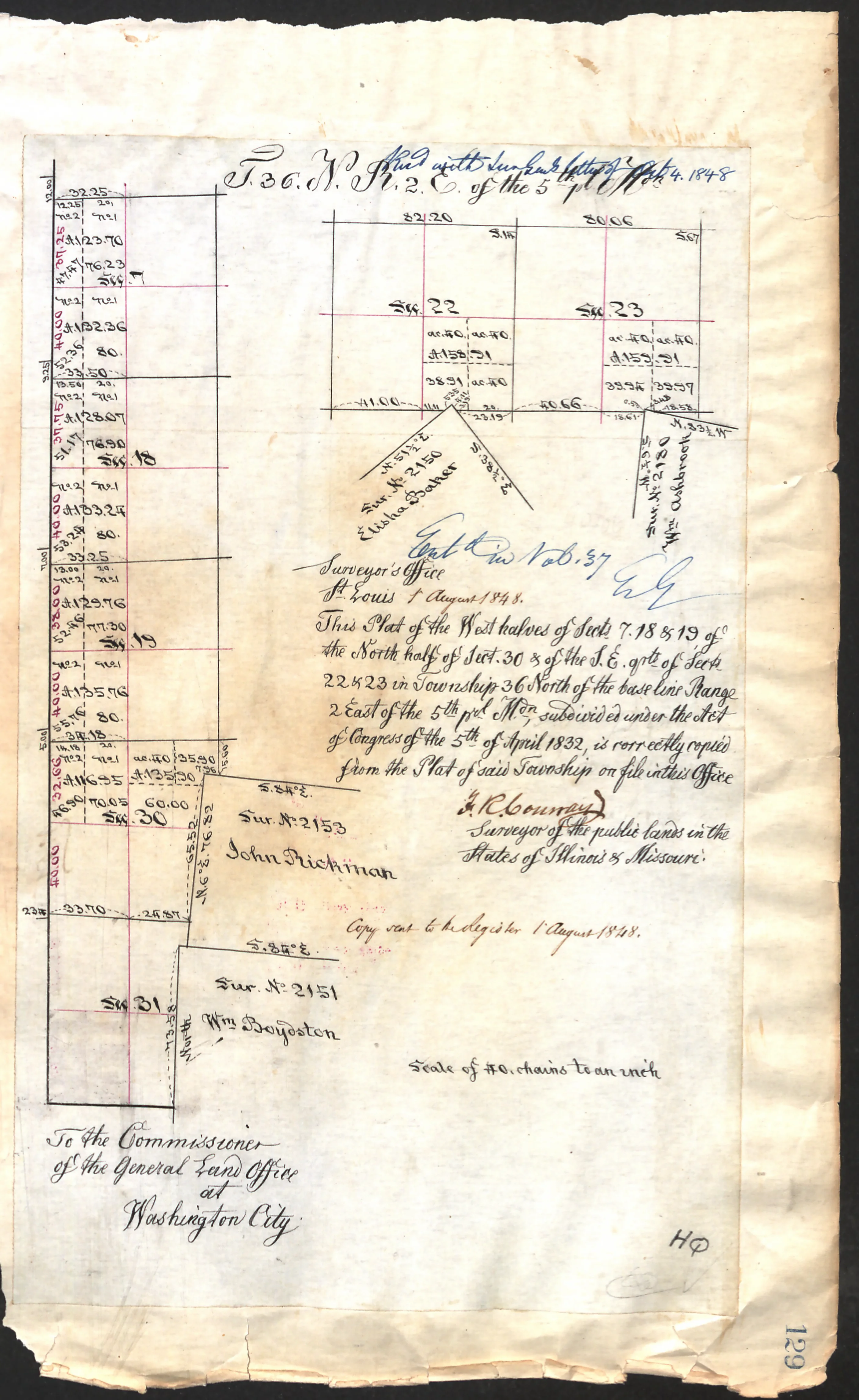
The survey is received for record at St. Louis by Antoine Soulard, Surveyor General of the Territory of Louisiana — the surveyor's own recorded copy of Baker's claim, rather than a document Baker produced himself.
Survey plat recording notation; American State Papers, Public Lands, Vol. II, p. 441.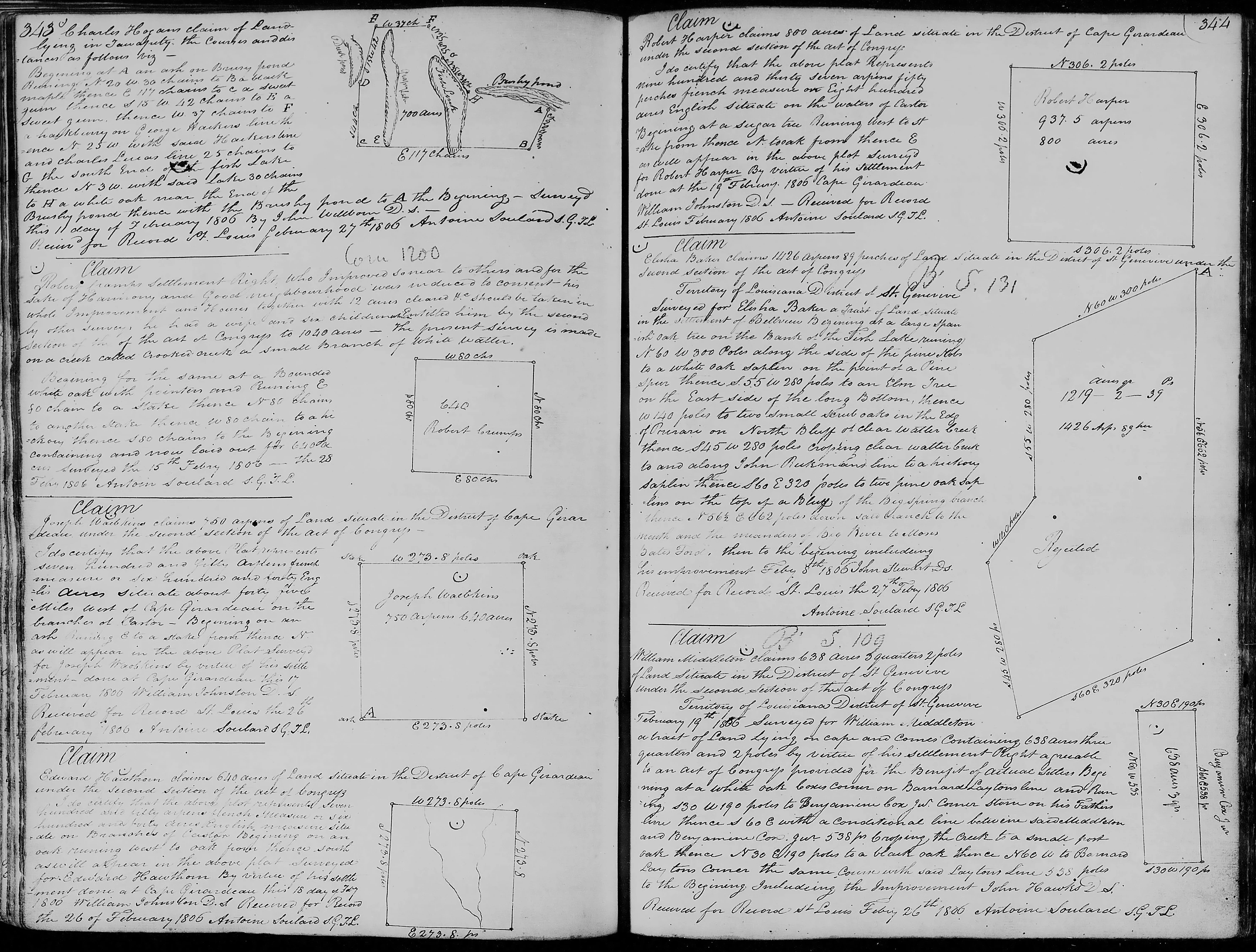
Baker's claim is heard before the Board of Land Commissioners. Walter Crow gives sworn testimony describing the settlement history and household as above.
American State Papers, Public Lands, Vol. II, p. 441.The day after his own hearing, Baker gives sworn testimony in the Board of Land Commissioners case of neighbor John Cooper, who claimed 748 arpents 68 perches in Bellevue, district of Ste. Genevieve, under a survey certified 28 February 1808. Baker states that Cooper settled the tract in 1804, raised a cabin, and cultivated a small spot, and that Cooper had a wife and child on 20 December 1803. It places Baker in the Bellevue community not just as a claimant but as a neighbor other settlers could call on to vouch for their own settlement history.
American State Papers, Public Lands, Vol. II, p. 424. The source gives the testimony date as "June 27, 1866" — almost certainly a transcription error for 1806, the day after Baker's own hearing.John Cooper's claim — the one Baker testified in — is rejected. With Lucas, Penrose, and Bates presiding, the Board finds "this claim ought not to be granted," six weeks before it rejects Baker's own Bellevue claim on the same general grounds.
American State Papers, Public Lands, Vol. II, p. 424.The Board of Land Commissioners (Lucas, Penrose, and Bates) rejects Baker's claim outright, with no dissent recorded. The word "Rejected" is written directly across the survey plat itself at this time.
American State Papers, Public Lands, Vol. II, p. 441; annotation on the original survey plat.Recorder of Land Titles Frederick Bates issues his report on settlement-right claims. Baker's claim (No. 131) is listed: of the original 1,426 arpents 89 perches surveyed, 640 acres are recommended for confirmation.
Confirmations of Land Claims in Missouri, by the Act of 29th April 1816 — Settlement Rights, per Recorder Bates' Report of 2 February 1816.Congress enacts the confirmation act formally adopting Bates' report, confirming 640 acres of Baker's original claim under Survey No. 2150.
Act of Congress, 29 April 1816.Elisha Baker and his wife Polly convey the confirmed 640 acres — including their own home place on Big River — to John Hutchings of Casey County, Kentucky, for $1,200. Recorded 3 June 1816, Washington County.
Indenture, Elisha Baker & Polly to John Hutchings, 5 May 1816, Washington County, Territory of Missouri.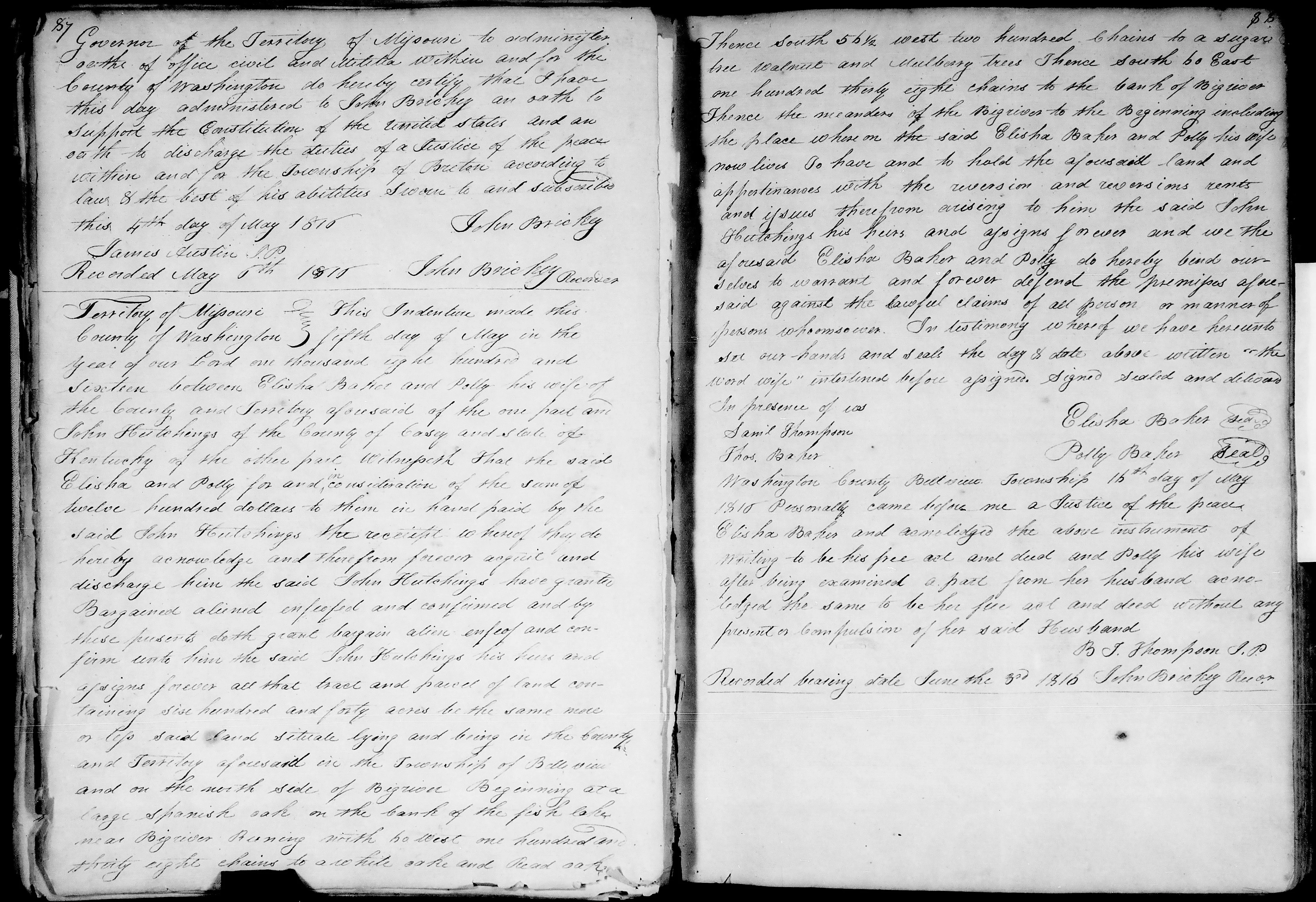
Read the full deed transcript
Loading transcript…
A resurvey is executed to physically locate and mark out the specific 640 acres confirmed by the 1816 act, within the boundaries of Baker's original survey of 1,426 arpents 89 perches.
Confirmation record, "Execution of survey" date.The resurvey is formally returned to the Recorder of Land Titles.
Confirmation record, "Return to recorder" date.The federal patent for Survey No. 2150 (640 confirmed acres) is issued — not to Elisha Baker himself, but to "Elisha Baker's representatives," indicating Baker had died by this date. Recorded in Volume 7, pages 88–91, General Land Office, Washington City. The confirmation corresponds to Certificate No. 1037 (Recorder of Land Titles).
1849 deed, John Hutchings Sr. to John Hutchings Jr., referencing the patent; land office correspondence of 27 March 1829.A land office letter, referencing Certificates No. 1083 (Moses Bates) and No. 1037 (representatives of Elisha Baker), notes the patent has issued in Baker's case and returns Baker's original 1816 deed to Hutchings — the document having been held as supporting evidence throughout the confirmation process.
Land office transmittal letter, 27 March 1829.Aftermath — later transfers
Selected, post-1829
For reference, the confirmed 640 acres and adjoining pieces of Baker's original survey continued to change hands for decades after the patent: part of the 640 acres passed from Hutchings to Thompson James and William Miller, then to Jordan W. Jeffress (1838), then to a buyer named Daniel Boon for $3,300 (1843); a separate 400-acre remainder was retained by Hutchings and divided between his sons as late as 1849; and a 22-acre mill site sold off by Hutchings passed through a sheriff's sale to partition the heirs of Thorne Byrd, eventually reaching Hanson Wallace and Preston M. Robinson by 1861.